Introduction:
Digital Soil Mapping (DSM) represents “the creation and population of spatial soil information systems by the use of field and laboratory observational methods coupled with spatial and non-spatial soil inference systems”. Soil science, geographic information science, quantitative methods (statistics and geo-statistics) and cartography are combined within the DSM framework. DSM methods are used to estimate the spatial distribution of soil classes (eg: soil series), and /or soil properties (eg: soil organic matter), and can be employed at various scales (from individual field to countries), and have proven valuable for developing more quantitative, more accurate, and more precise soil maps. DSM is now moving inexorably from the research phase to the effective production of soil map, it is destined to play a great role in the development of current and future soil spatial system.
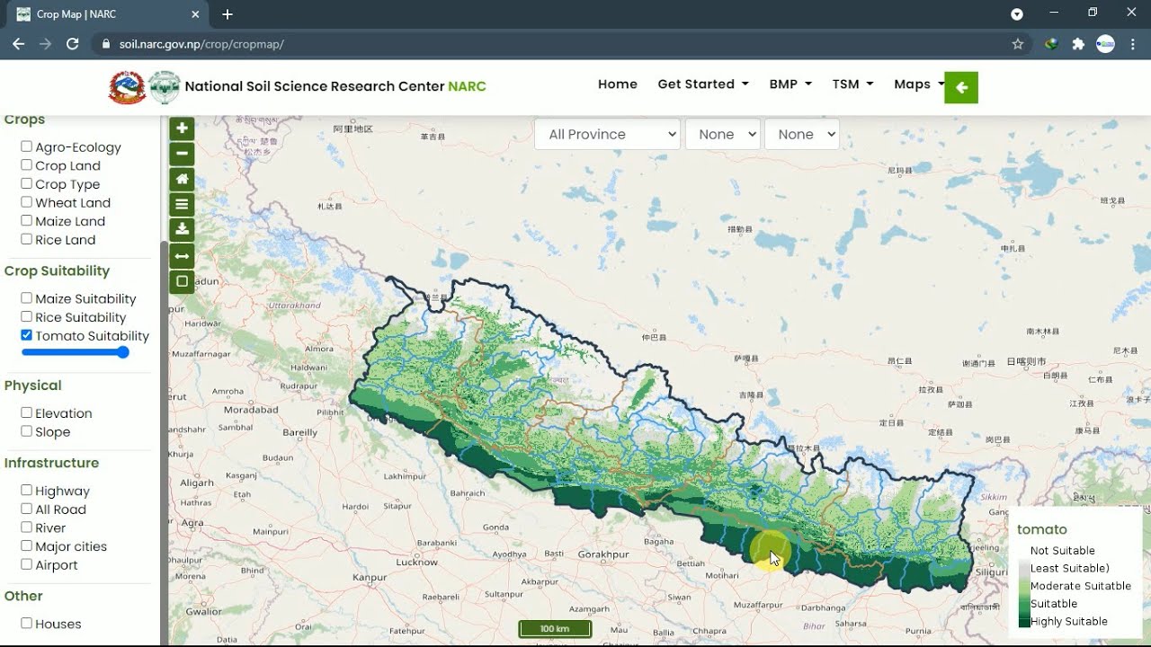
In this digital era, On 24th Feb 2021, Nepal has also launched a nationwide digital soil map for the first time aiming to support for the soil fertility management in the country. Nepal has become the first south Asian country to released its digital soil map. Nepal Agricultural Research council’s (NARC) National Soil Science Research Centre (NSSRC) in the collaboration with financial support of International Maize and Wheat Improvement Center (CIMMYT). According to NARC, the maps were prepared using soil information from 23,273 soil samples that were collected from 56 districts covering all 7 provinces of Nepal. These soil properties were combined with a stack of 168 remote sensing-based soil environmental factors and the spatial predictions were generated using a machine learning method and the random forest.
Features:
DSM for Nepal provides access to location-specific information on soil properties for any province, district, municipality or a particular area of interest.
It uses computer technology to show various elements of the soil their effect on the soil and is based on the results of soil analyzed in the laboratory.
By using NARC’s free application programming interface, all the information relation to the soil, crop suitability, best management practice, and disease troubleshooting can be obtained.
The map would be updated by collecting soil samples in different times as the productivity and quality of soil would change based on the crop plantation, use of fertilizers and other factors.
Importance and scopes:
First of all, farmer get to know about the soil fertility and productivity by visualizing the elevation, slope nutrients availability, organic matter content, soil PH, of their field.
Not only farmers, it is paramount to policy makers, researchers and technicians who would be directly benefited from this map as policy makers can introduce specific policy based on the quality of soil for specific places and technicians too can use effective technology.
Government can use map to make more efficient management decisions on import, distribution and recommendation of appropriate fertilizer types, including blended fertilizers.
It assists to select suitable crops and design extension programs for improving soil health and uplifting the production of crops and also conserve soil from deterioration.
Demand for soil information is increasing from agriculture and other sectors, for instances, horticulture development officers might have to find how much area under their jurisdiction is suitable for fruit crops and where it is located, is it scattered of clustered, and so on.
The private sector can utilize the acquired soil information to build interactive and user-friendly mobile apps that can provide soil properties fertilizer-related information to formers as part of commercial Agri-advisory extension services.
These soil maps will not only help to increase the crop yields, but also the nutritional value of these crops, which in return will help solve problems of public health such as zinc deficiency in Nepal’s population.
Challenges:
Mapping soil resources at national scale in country like ours is a challenge because of limited soil data available and efforts to collect them.
In some locations, the soil-landscape relationship is difficult to determine and represent. Eg: areas with heterogeneous parent materials.
The main challenge is to be flexible enough to satisfy present and future user demands. So that the up coming generation could be trained well in field work and also mastering modern spatial analysis techniques.
The objectives of DSM for Nepal will only meet if farmers of nooks and corner of Nepal get access to and adopt this technology to their field.
However, the absence of a well-developed soil information system and soil fertility maps has been lacking for decades, hope this will be the turnover in the history leading to adequate strategies for soil fertility and fertilizer management to improve crop productivity. DSM is expected to support farmers in accessing soil information to adopt an integrated soil fertility management so that the existing problems of food security and soil degradation will be addressed.


